Monthly Outlook

- Published
Very unsettled but mild weather will continue across the UK through early November, with periods of heavy rain and strong winds at times.
The middle and latter part of the month may see a greater chance of drier spells, although it is expected to turn colder.
Saturday 1st November to Sunday 9th November
Mild but unsettled then drier later
The weekend will bring further heavy showers and more prolonged periods of rain, with a risk of isolated thunderstorms and occasionally strong, gusty winds.
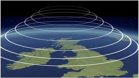
The remnants of Hurricane Melissa are unlikely to have a direct impact, as the remaining low-pressure circulation moves northwest of the UK.
However, it could enhance available moisture and bring additional heavy, possibly thundery rain in places into Monday, along with strong winds once again.
The wettest areas are likely to be in northern and western regions.
Unsettled conditions are expected to continue through at least the middle of the coming week, with low pressure and frontal systems remaining the dominant features, moving towards and across the UK from the west and southwest.
As a result, there will be further bands of rain interspersed with brighter interludes and scattered sharp showers. Thundery showers are still possible, with a risk of hail.
There may be a better chance of a drier day in the second half of the week under a transient ridge of high pressure, and by the weekend there are some indications that high pressure may start to gain more of a foothold—although this remains very uncertain.
Winds will be strong at times, at least until the weekend, but often from the south or southwest, so conditions will remain milder or even much milder than average.
Monday 10th November to Sunday 16th November
Drier and still milder than average
Through the middle of November, the forecast carries low confidence, with longer-range models placing areas of high pressure in different locations — either centered over the eastern Atlantic or across continental Europe.
Either way, temperatures are more likely to remain above the November average. However, with calmer conditions at times, nights are likely to be chillier.
With at least a partial presence of high pressure, there should be an increased likelihood of drier periods compared to the coming week, though this does not rule out the occasional chance of light rain here and there. Precipitation totals are expected to be below average for the week, or near normal at most.
There will also be fewer opportunities for notably strong winds.
Monday 17th November to Sunday 30th November
Dry periods but becoming chillier later
For the second half of November, the forecast carries relatively low confidence, as extended-range models continue to differ regarding the position of high pressure — either over mainland Europe or near (or northwest of) the UK.
Nevertheless, this should generally result in relatively dry conditions, with precipitation amounts likely to be below average in most areas, or near seasonal levels in some places.
Temperatures are expected to show a downward trend, particularly later in the month, when there are indications that high pressure could become centred closer to Iceland and Greenland.
Should this pattern develop, colder air could be directed towards the UK. While this outcome is far from certain, temperatures may trend closer to seasonal norms with an increased likelihood of chillier conditions.
Under calm and clear skies, the risk of frost and fog will also be greater.
Further ahead
In Tuesday's outlook, we'll see whether the models begin to show better agreement on the alignment of the expected high pressure through the middle and end of November.
- Published25 October

- Published7 April 2022